
Route: Windy Gyle
Area: Northumberland
Date of walk: 10th June 2015
Walkers: Andrew and Gilly
Distance: 7.7 miles
Weather: Mostly sunny
Windy Gyle is one of the best known hills in the Cheviots and the fence along its summit ridge marks the border between England and Scotland. Our journey to the start point was a worthwhile trip in its own right, along a narrow winding road which took us into a remote hinterland near the head of the Coquet Valley
From the small car park beyond Barrowburn we followed a track round the foot of Shorthope Hill before starting the climb up to Windy Gyle. It was a pleasant ascent set at an easy gradient
There were huge views from the summit in all directions – a wonderful place which lives up to its star billing
Just below the summit we debated whether to have our picnic in Scotland or England – we opted for Scotland, a few feet to our right, just because we could
We descended back to the start along a path known as The Street, easy going all the way, and from which there were fantastic views in all directions
Click on the icon below for the route map (subscribers to OS Maps can view detailed maps of the route, visualise it in aerial 3D, and download the GPX file. Non-subscribers will see a base map)

Scroll down – or click on any photo to enlarge it and you can then view as a slideshow

Dawn breaks in Seahouses and fishing boats leave the harbour to go out to sea

Pictures taken from the balcony of Harbourside Cottage, where we were staying for 3 nights


Later that day we drove to the remote head of the Coquet Valley to start our walk

The initial section was along a track with Rowhope Burn on our left and Barrow Law on our right

Near Rowhope

Downtown Rowhope


At a ford just beyond Rowhope we left the track to climb up the grassy slopes of Trows Law to the left

Looking back to the remote farm at the Trows - no mains water or electricity and the nearest school is 9 miles away

Heading up Trows Law - it’s a nice easy climb

Looking back along the path

Onward and upward

Another view back into Coquetdale as we approach the summit of Windy Gyle

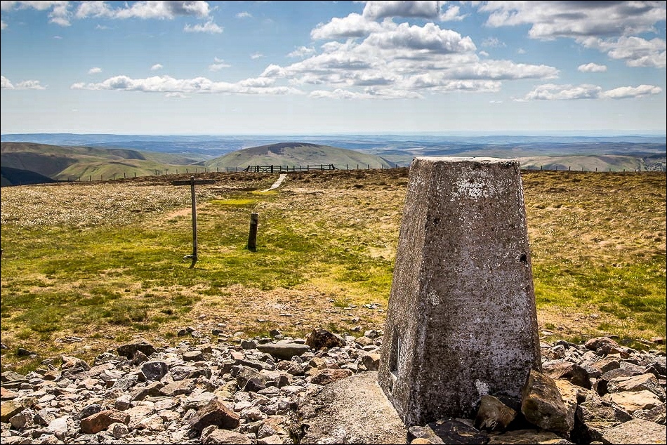
Windy Gyle, one of 6 summits in the Cheviots which top the 2,000 feet mark

The English/Scottish border straddles the summit and the hill is a Scottish ‘Donald’ and an English ‘Hewitt’ and ‘Nuttall’

Looking back into Northumberland

We descended for a short distance…

…and enjoyed our picnic in Scotland

Looking back along the border fence to Windy Gyle

Black Braes

We encountered a herd of rare Cheviot Goats - these are wild animals, first brought to Britain in Neolithic times


We descended along an ancient path known as The Street


Further along The Street, Coquetdale comes into view again

Looking back towards Windy Gyle

And looking across to our ascent route

Coquetdale below - and the car park. What a wonderful walk in this remote part of Northumberland

On the way back to Seahouses, we visited Cragside, the first house in the world to be lit by hydroelectricity generated from this lake

Cragside House. We only had a hour or so to spare - a full day is needed to explore this vast estate

Debdon Burn

We cross over the Iron Bridge

Cragside House

Sunset back at Harbourside Cottage in Seahouses, looking to the Farne Islands. The red boat ‘Serenity 1’ will be taking us there tomorrow…
