
Route: Wast Water from Nether Wasdale
Area: Western Lake District
Date of walk: 12th January 2017
Walkers: Andrew
Distance: 5.9 miles
Weather: Mostly cloudy, some sleet showers, very cold
Wast Water is only 13 miles away from our home in the North West lakes, but such is the nature of the intervening terrain that it takes an hour to drive there, and involves a long diversion along the west coast of the country in order to circumvent the mountains. That’s my excuse for not having visited the wonderful valley of Wasdale for a while. Absence makes the heart grow fonder though and I was greatly looking forward to this walk
I drove over to Nether Wasdale near the head of Wast Water. There is some parking in this quiet village but it’s best not to clutter the place up and so I took advantage of the walkers car park beyond the village, by Cinderdale Bridge
I joined a track leading through Easthwaite Farm which eventually emerges at the head of Wast Water – a great moment, for this is one of the most spectacular places in the country. After crossing Lund Bridge I followed the lakeshore path which joins the road to Wasdale Head
There followed a lengthy road section but this wasn’t an issue – the only traffic I encountered were sheep. The classic views towards lakeland’s finest fells got better and better as I progressed, until it was time to start the return leg and head along the road to Greendale
At the foot of Buckbarrow I left the road to join a path which took me back through the fields to the start of the walk. The weather had been very mixed, but after the walk was over there was an improvement in the light – as the final photos will reveal…
For other walks here, visit my Find Walks page and enter the name in the ‘Search site’ box
Click on the icon below for the route map (subscribers to OS Maps can view detailed maps of the route, visualise it in aerial 3D, and download the GPX file. Non-subscribers will see a base map)

Scroll down – or click on any photo to enlarge it and you can then view as a slideshow

Red squirrel in the garden before I set off this morning

The start of the walk as I cross Cinderdale Bridge

I follow the track to Easthwaite Farm

Approaching the Wasdale Screes

Looking along the Screes


A quick diversion to the foot of Wast Water (the deepest lake in England at 258 feet)

The pumping station

Looking past the boathouse towards Yewbarrow at the head of the lake

I retrace my steps for a short distance and join the path beside the River Irt

I cross Lund Bridge to follow a path through Low Wood, which follows the other bank of the river as it merges with Wast Water

Low Wood

I pass by the pumping station, this time on the other side of the river

Path along the edge of Low Wood at the foot of Wast Water

Wasdale Head - a few more photos of this iconic place will appear later

I pass through the grounds of Wasdale Hall, which was under wraps today and undergoing essential maintenance work by the National Trust

Wasdale Head again at the start of the road section beside Wast Water

The Screes again - there’s a path which runs a few feet above the lake. I tried it once - never again

Yewbarrow

Lingmell

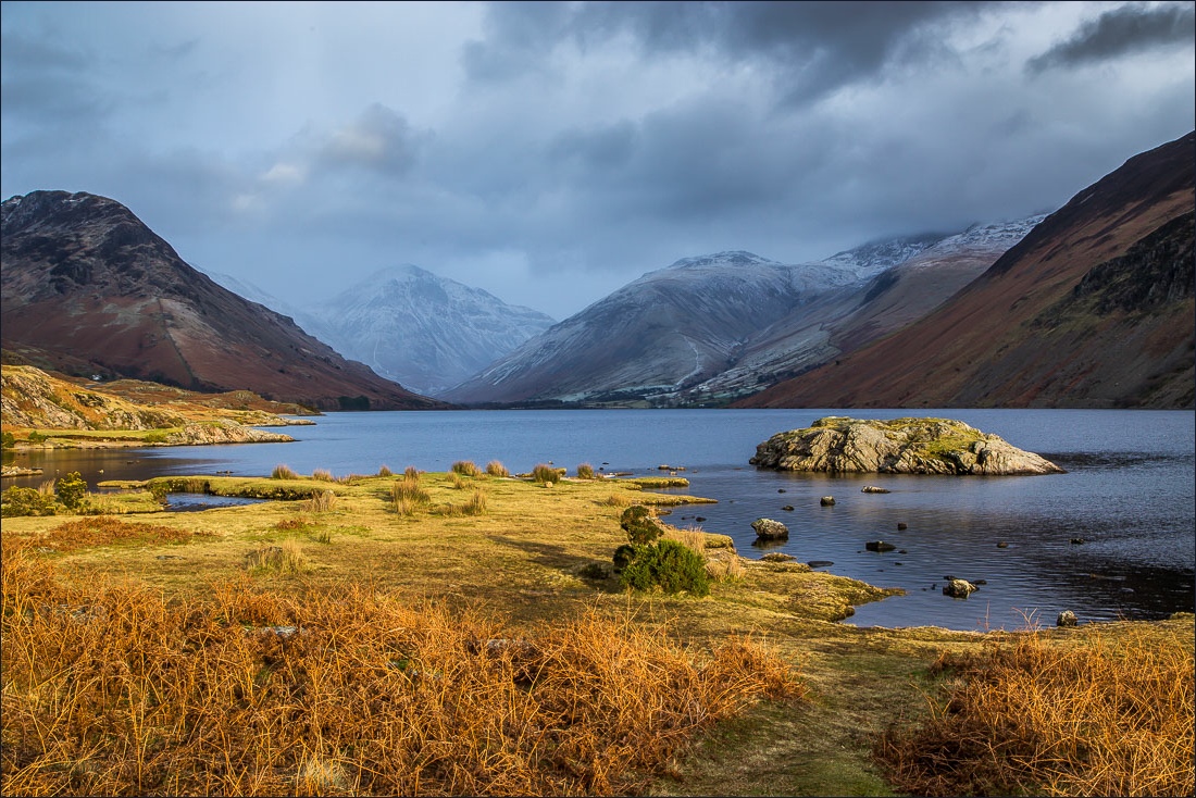
Yewbarrow, Kirk Fell, Lingmell and a hint of Scafell at the head of Wasdale

A jarring contrast

The Screes again as I reluctantly turn away from the head of the lake to start the return leg…


Greendale ahead


Lingmell and Scafell with their heads in the clouds

Herdy

Another view back along the road

Sleet shower passing by Buckbarrow on its way to the head of the lake.


Buckbarrow

Almost at the end of the roadside section before I turn off to the left at Buckbarrow farm

I pass through Buckbarrow

An intricate pattern of dry stone walls along this section of the walk…


A final look back to Wasdale Head as I near the end of the walk

Back to Cinderdale Bridge and the end of a wonderful low level walk, but not the end of the day…

I drove back to the shore of Wast Water, where I’d walked earlier - this is a snow shower over Wasdale Head…

…and this is the same scene 5 minutes later

The difference between 1/30th second exposure…

…and 30 seconds

And again…


Whatever the camera setting, no photo can do justice to the majesty of Wasdale Head
