
Route: Loweswater
Area: Western Lake District
Date of walk: 4th September 2018
Walkers: Andrew and Gilly
Distance: 5.9 miles
Ascent: 1,000 feet
Weather: Sunny
Today’s walk was a variation on one of our favourites, a delightful and varied route which we’ve walked many times. We normally park in the small car park at Maggie’s Bridge near the head of Loweswater, but it was closed today, so we drove to the foot of the lake and parked in one of the spaces there. We followed the path along the foot of Loweswater to Hudson Place and decided to walk anti-clockwise for a change, turning off at Hudson Place to follow a path through the fields, past Jenkinson Place and to the northernmost edge of the Lake District
The path took us to an ancient track known locally as the Loweswater to St. Bees Coffin Road. This mid-level route contours around the fellside with some wonderful views, looking north to Scotland and the Solway Firth and south into the heart of Lakeland. We followed the path above Holme Wood and Loweswater and beyond the head of the lake we descended towards High Nook Tarn. The small bridge over Highnook Beck, which was washed away in the floods, still hasn’t been replaced but fording the small beck was a simple affair. We then passed through High Nook Farm and just beyond it joined the path which leads past Watergate Farm to the head of Loweswater
From here we walked along the lakeshore path through Holme Wood and on reaching Hudson Place we retraced our steps back to the start. This is a walk with a huge variety of scenery to be enjoyed along the way – fells, lakes, woodland, grazing land, meadows, valleys – all of it beautiful and shown in its best light in today’s weather
For other walks here, visit my Find Walks page and enter the name in the ‘Search site’ box
Click on the icon below for the route map (subscribers to OS Maps can view detailed maps of the route, visualise it in aerial 3D, and download the GPX file. Non-subscribers will see a base map)

Scroll down – or click on any photo to enlarge it and you can then view as a slideshow

Before the start of today's walk I made a dawn visit to Crummock Water, here looking over Woodhouse Islands to Haystacks

Woodhouse Islands again

Nether How at the head of Crummock Water

I continued to Buttermere in search of the light - this is the bothy at the head of the lake

A wider view, taken from Hasness, with Fleetwith Pike and Haystacks framing the scene

An hour or two later, the start of today's walk from the parking area near the foot of Loweswater

We walk towards Hudson Place, at first through fields...

...and then along the access road

Loweswater from Hudson Place

We turn right here to walk away from the lake towards Jenkinson Place

Looking across to the Loweswater Fells

We walk through the fields towards Jenkinson Place

Looking back to Loweswater, with Grasmoor dominating the horizon

The path takes us above Jenkinson Place

Looking across to Askill

Jenkinson Place, Hudson Place and Loweswater

What counts for traffic in these parts...


On the fringes of the Lake District now, we head uphill

We turn left here to join the old coffin road, where bodies were taken for a Christian burial at the abbey at St Bees

Looking back to Fangs Brow, with the hills of Scotland in the distance

We follow the coffin road, with Burnbank Fell up on the right

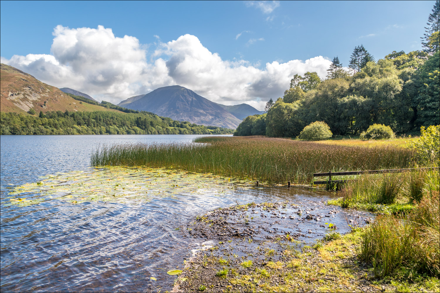
Loweswater comes into view again...


Crummock Water beyond the head of Loweswater

Looking across the foot of the lake to the start of our walk

We turn left at this gully, formed by Holme Beck

For anyone looking to shorten the walk, turn left here to descend through Holme Wood. We carried on to the right

A view back along the coffin road

Bonnie contemplates the way ahead as we follow the path above Holme Wood...

Black Crag below Gavel Fell

Beyond Holme Wood now, and Whiteside, Grasmoor and Mellbreak come into view

We follow the path towards Highnook Tarn

Grasmoor and the foot of Crummock Water

In the absence of the old wooden footbridge we ford Highnook Beck - not an issue after such a dry summer

Low Fell, sweet Lorton Vale, and Whiteside

After passing through High Nook Farm we branch off towards Loweswater - here looking back to Grasmoor

We arrive at the head of the lake

Low Fell

We follow the path through Holme Wood, managed by the National Trust

Grasmoor and Mellbreak from the bothy by the lakeshore

Holme Wood

Ignoring the gate to the left, Bonnie climbs the ladder stile as usual

Views back along Loweswater...


We arrive back at Hudson Place - this completes the circuit and from here we retrace our steps back to the start

The end of a wonderful walk and one which we could never tire of
