
Route: Circuit of Lorton Vale
Area: Western Lake District
Date of walk: 3rd June 2014
Walkers: Andrew
Distance: 9.7 miles
Weather: some sunny intervals, improved gradually – glorious at end
The last time I walked round the valley, I was snowed in for three days. Today was a chance to do a longer version of that walk in better weather
I started from home but for anyone else following this walk there are car parking opportunities in various places along the way including Lorton, Scale Hill or Lanthwaite Green. After walking down the lane for a short distance I followed a path through fields into Lorton about 2 miles away. After crossing the new bridge at Low Lorton I walked along the Thackthwaite road – this isn’t an issue, it’s a very quiet lane with hardly any traffic
I turned off the lane at Foulsyke after admiring the jaw dropping view into the Buttermere valley, surely one of the best in the lake district. At Scalehill Bridge I walked along the banks of the Cocker through Lanthwaite Wood to the foot of Crummock Water. By now the weather was almost perfect
I made my way over to Lanthwaite and back home along the elevated path which runs along the foot of Whiteside, giving wonderful views all the way – including Scotland today
Click on the icon below for the route map (subscribers to OS Maps can view detailed maps of the route, visualise it in aerial 3D, and download the GPX file. Non-subscribers will see a base map)

Scroll down – or click on any photo to enlarge it and you can then view as a slideshow

Red squirrel in the garden earlier in the day

As I leave the house there’s a view across to the far side of Lorton Vale overlooked by Low Fell and Fellbarrow

A short distance along the lane I go through this gate and follow a path through the fields

Looking across the fields to Dodd, with Hopegill Head and Whiteside beyond

High Swinside to the right of the picture

Old barn shortly before Lorton

High Lorton ahead

A few minutes earlier whilst in the fields the farmer had been muck spreading and Bonnie seized the chance to roll in the muck - the canine equivalent of applying Chanel No. 5. I was glad to reach the beck where she could have a swim and wash it off

Stand back - here comes The Shake

Leaving High Lorton, I follow the sign to Low Lorton

The new bridge over the River Cocker, built after the 2009 floods washed away the old one

On the lane from Low Lorton to Thackthwaite

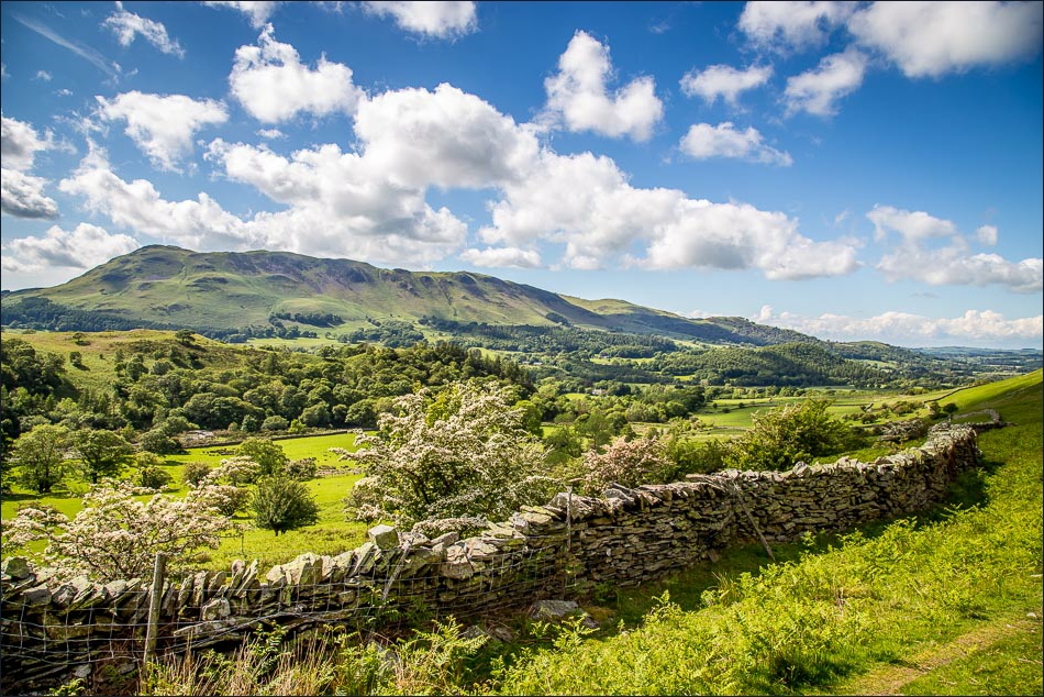
Looking back across Lorton Vale to Millbeck

Entering Thackthwaite I take care to avoid the speeding squirrels

Mellbreak

Low Fell

The sublime view of Crummock Water from Foulsyke. I leave the lane at this point to follow the path gently downhill

There’s a constant risk of tripping up as it’s hard to take your eyes off the view ahead


I take the path which follows the bank of the Cocker, here looking towards Mellbreak

Crummock Water and left to right Rannerdale Knotts, the High Stile Range and Mellbreak

I follow the path along the shore of the lake for a short distance

The boathouse, looking towards the Loweswater fells - at this point I leave the shore to climb up through the woods

Out of Lanthwaite Wood and heading towards Lanthwaite Green and Whiteside

Grasmoor

Looking along Lorton Vale

I follow the sign to Fell End Bridge over Liza Beck

Looking along the valley from the path at the foot of Whiteside

Low Fell on the far side of the valley

Looking back along this wonderful path

Criffel in Scotland can be seen in the distance as I near home

I go down the outgang near Miller Place

Buttercup meadow near the end of a wonderful walk
