
Route: Lenk to Lauenen
Area: Bernese Oberland, Switzerland
Date of walk: 19th June 2019
Walkers: Andrew and Gilly
Distance: 11.6 miles
Ascent: 3,200 feet
Weather: Sunshine and blue skies, hot
Day 5 of our journey in the Bernese Oberland dawned, and it was time to move on from our overnight base in Lenk (the very comfortable and friendly Hotel Krone). It promised to be another hot day and, since we had a big ascent ahead of us, we packed as much water as we could comfortably carry. Our walk from Lenk to Lauenen would take us up to the Truttlisberg Pass at a height of 6,690 feet before descending to Lauenen in the adjoining valley
We climbed above the village to enter into woodland and followed a steep path up the Wallbach gorge, passing by a spectacular waterfall along the way. Beyond the woodland we entered into Alpine pastures, with ever improving views of the snow covered peaks around us. There was still some lingering snow, and we had to walk across several patches
Eventually we arrived at the Truttlisberg Pass, tired but happy. Looking back we could see the Hahnenmoos Pass, which we’d crossed on yesterday’s walk, about 10 miles away. Beyond that there was a distant view of the snow covered Eiger and Mönch, two of the Swiss giants standing at over 13,000 feet high
Our arrival at the pass brought with it a whole new vista, just as spectacular as the one we’d left behind. We set off on the long descent to Lauenen, initially along a vague and quite rough path through rutted pastures, before emerging onto an easier track which zigzagged down the mountainside. The wild flower meadows along the way were glorious, and enhanced the spectacular mountain scenery
Eventually we arrived at our destination, the village of Lauenen. During the course of our 6 hour journey, through some of the most beautiful landscape imaginable, we hadn’t encountered a single walker
Click on the icon below for the route map
![]()
Scroll down – or click on any photo to enlarge it and you can then view as a slideshow

The morning of the walk, and a view from our overnight base in Lenk - the excellent Hotel Krone

The start of our journey to Lauenen as we look back over Lenk...


We enter woodland and head up the Wallbach Gorge

A view back into the valley as we cross a small bridge

We climb up some steps which pass by this waterfall


We emerge from the woodland - this narrow path soon joins a wide track....


We leave the track to follow a vague waymarked path uphill

Looking back towards Lenk

We continue uphill towards the Truttlisberg Pass


Another view back, and we can see the Hahnenmoos Pass, which we'd crossed on yesterday's walk, about 10 miles away. In the far distance is The Mönch (13,474 ft)

We pass by an old chalet


We top up our water supplies from a mountain stream as it's a hot day

The Stubleni crags, below the higher mountains, are an alternative route to the pass, but the path was closed due to snow

The Eiger now comes into view in the far distance, to the left of The Mönch. The prominent peak near the centre is Wildstrubel (10,643 ft)

The Stubleni Crags again

The path contours around the mountainside towards the pass

We pass through a few small remaining snowfields

The Stubleni Crags again

Alpine flowers seen along the way, including crocus flowering in places where the snow had just melted

The Stubleni Crags as we near the top of the pass

A final look back down the valley...

...we arrive at the Truttlisberg Pass (6,700 feet) and a new vista reveals itself

Start of the long descent as we head initially towards Spitzhorn

We follow a waymarked path through rutted pastures

Lauenenhore and Giferspitz on our right

Wildhorn to the left of the picture

The Lauenen Valley below

Spitzhorn again

We join a wide track which zigzags down the mountainside...


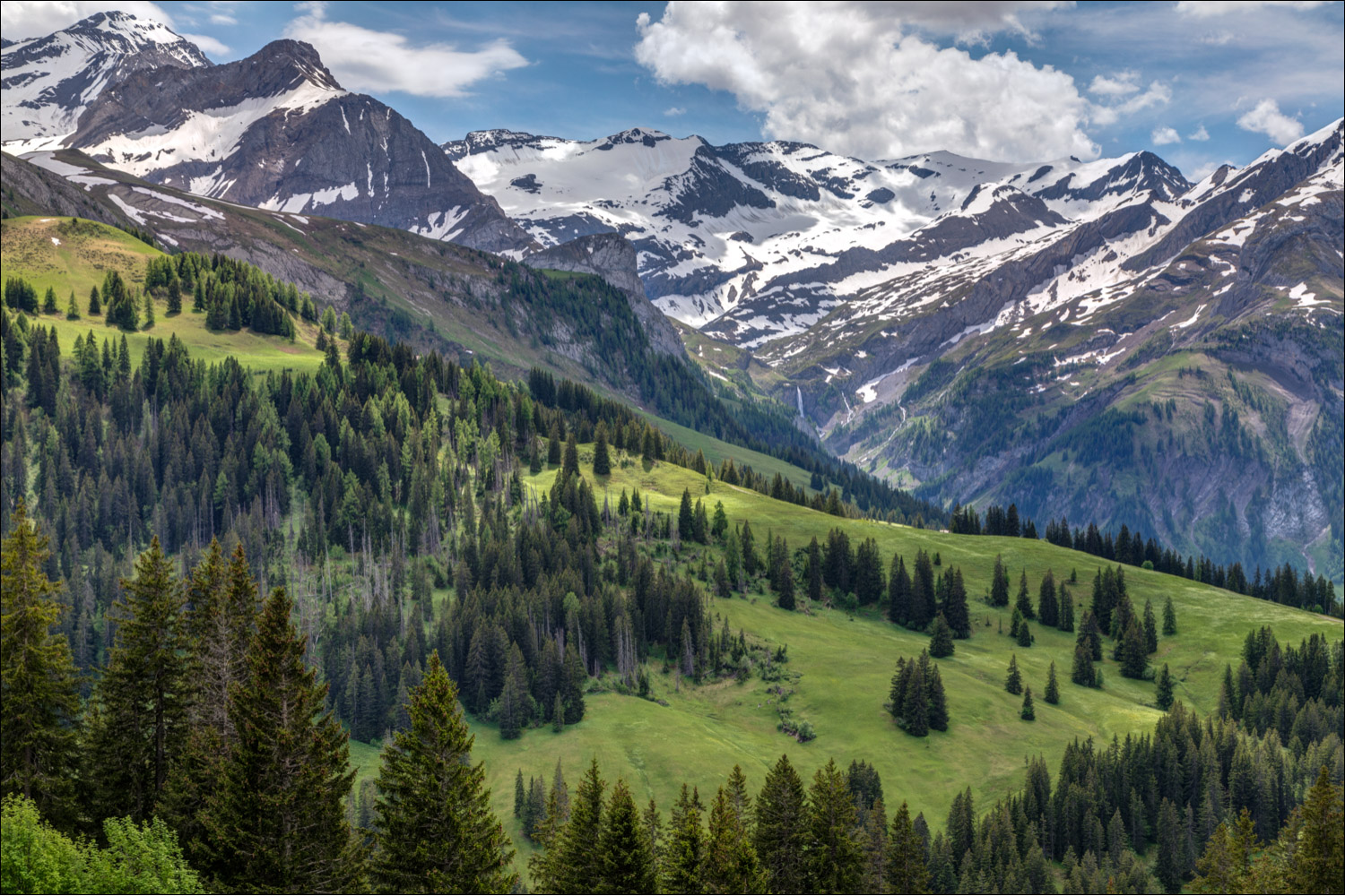
On the right of the picture, we can just make out the two waterfalls of Tungelschuss and Geltenschuss at the head of the Lauenen Valley...

...a closer view

A lovely section of the walk as we pass through wild meadows at their peak...


The head of the Lauenen Valley

A short road section before we follow another path through the meadows


Looking north along the valley, in the direction of Gstaad

Wild orchids


A sad shed

Another view of the Tungelschuss waterfall again as we approach the valley floor

We arrive in Lauenen and walk to the Hotel Alpenland on the outskirts of the village

Dusk the same day, and a view of the Tungelschuss waterfall from the hotel, which is set in a wonderful location

