
Route: Lanthwaite Hill
Area: Western Lake District
Date of walk: 10th December 2015
Walkers: Andrew
Distance: 4.7 miles
Ascent; 400 feet
Weather: Mostly overcast with some brighter spells, cold and windy
I can’t recall a more miserable spell of weather in the Lake District – with the odd exception it seems to have rained every day non stop for the last 6 weeks. This culminated last weekend in ‘Storm Desmond’ which caused some of the worst flooding ever experienced in Cumbria
Today was mercifully dry and as I wanted to check out conditions in the Lorton area I decided on one of my favourite local walks, Lanthwaite Hill from which there are tremendous views in all directions, gained in return for little effort. It’s a walk I’ve followed many time and one which I could never tire of
I parked as usual in the National Trust car park at Scale Hill and within 10 minutes or so was admiring the view from the top. I descended through Lanthwaite Wood to the shore of Crummock Water, where there was a lot of debris following the floods, but the paths were all clear
It was reassuring that familiar landmarks along the way had survived the floods, and the walk was as lovely as ever
For other walks here, visit my Find Walks page and enter the name in the ‘Search site’ box
Click on the icon below for the route map (subscribers to OS Maps can view detailed maps of the route, visualise it in aerial 3D, and download the GPX file. Non-subscribers will see a base map)

Scroll down – or click on any photo to enlarge it and you can then view as a slideshow

Before the walk I drove to Low Lorton - the old bridge was destroyed by the 2009 floods and I was glad to see that the new one is undamaged

The River Cocker from the bridge, running high still a lot lower than during the recent flood

Continuing round the valley, I stopped the car at Foulsyke to admire the superb view of Crummock Water and the western fells

Next stop, Scale Hill Bridge (I’ll be starting the walk from here later on), and again no sign of damage

A shaft of sunlight over Crummock Water, looking towards Haystacks


Whiteless Pike

Last stop on this tour of the valley, looking back to the foot of Rannerdale Knotts

Later that day, the start of the walk from Scale Hill as I look across a swollen River Cocker towards Mellbreak

The water monitoring station - note the plaque on the side wall…

The river level in 2009 was 3.54m, around 3m higher than the norm. Last weekend it peaked at 3.14 here

Instead of following the main track to Crummock Water, I turn left here to follow a narrow path which leads steeply up the hillside

The rocky steps near the top

Deer gate leading out onto the fellside

On Lanthwaite Hill, with Whiteside and Grasmoor beyond

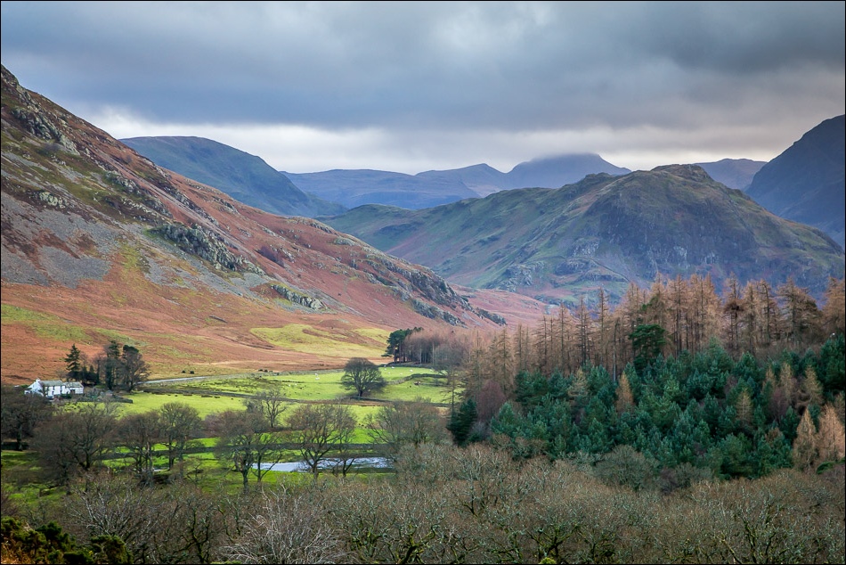
Sweet Lorton Vale from Lanthwaite Hill

Crummock Water

The foot of Low Fell

Grasmoor

Rannerdale Knotts

Descending round the edge of Lanthwaite Wood

Floodwater

Lanthwaite Wood

The boathouse on Crummock Water - hard to imagine that the water level was half way up the wall a few days ago

I follow the lakeshore path

Flood debris at the foot of the lake - it will soon be gone…

..but the view will always be there

Looking back to the boathouse

As I’d expected, the footbridge across the foot of the lake is impassable

The weir - the point at which Crummock Water ends and the River Cocker begins

Fallen tree on the way back to the start

Last photo of the walk - Bonnie on the track through Lanthwaite Wood

Later on, sunset over Lorton Vale and hopefully a sign of better weather to come
