
Route: Lanthwaite Hill
Area: Western Lake District
Date of walk: 8th April 2018
Walkers: Andrew and Gilly
Distance: 3.0 miles
Ascent: 400 feet
Weather: Sunny at first, clouding over
There was only time for a short walk this morning, so we chose one of our favourite local spots – Lanthwaite Hill (shown on the OS map as Brackenthwaite Hows). It’s a superb vantage point and hardly any effort is required to get to the top
What this walk lacks in distance it more than makes up for in the sheer beauty and variety of the terrain
We parked in the National Trust car park near Scale Bridge and instead of heading along the obvious path ahead turned steeply uphill to climb up through Lanthwaite Wood. There are a couple of short rocky sections to add interest, though they are very easy
The view from the top of Lanthwaite Hill was as beautiful as ever, with Lorton Vale, Loweswater, Crummock Water and the Buttermere fells displayed in all their splendour
We descended through Lanthwaite Wood to the boathouse on the shore of Crummock Water, and then walked back along the track beside the River Cocker. What a great little walk this is, one that we could never tire of
For other walks here, visit my Find Walks page and enter the name in the ‘Search site’ box
Click on the icon below for the route map (subscribers to OS Maps can view detailed maps of the route, visualise it in aerial 3D, and download the GPX file. Non-subscribers will see a base map)

Scroll down – or click on any photo to enlarge it and you can then view as a slideshow

Two days ago, a very unusual garden visitor - either polecat or ferret. Sadly it was injured, so I left out some food in the hope of aiding its recovery

The start of today's walk, looking across the River Cocker to Mellbreak from the National Trust car park at Scale Hill

We enter Lanthwaite Wood here and take the path to the left

The vast majority of folk follow the main track to the foot of Crummock Water, so as usual we had Lanthwaite Hill to ourselves

After a short and sometimes steep climb we leave Lanthwaite Wood and pass through the deer gate onto Lanthwaite Hill

We follow a path through the gorse in the direction of Whiteside

Lorton Vale

Looking back to Loweswater. The lake itself is out of sight

Low Fell

Carling Knott and Holme Wood

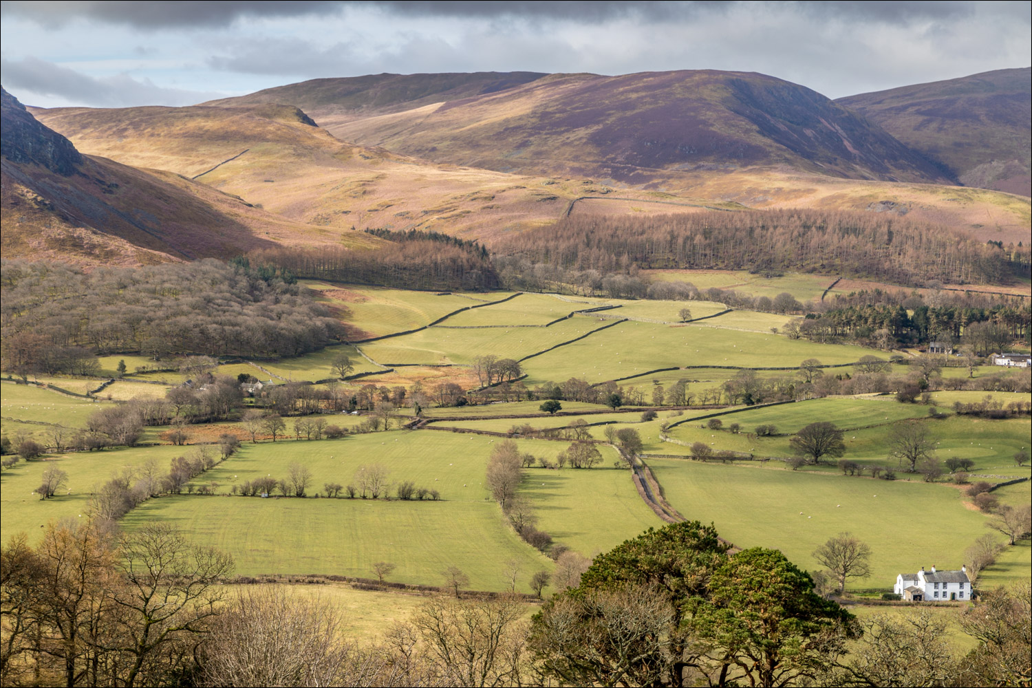
Lanthwaite Green

Crummock Water and Mellbreak

Foot of Mellbreak

Gavel Fell

Loweswater and its church

We descend back into Lanthwaite Wood

The High Stile Range

Entering Lanthwaite Wood

We pass by this enticing path

We follow the equally enticing path which skirts around the edge of the wood...


Foot of Grasmoor


Lanthwaite Green

We ignore another tempting path and continue to walk around the edge of Lanthwaite Wood

Descending to the shore of Crummock Water

Boathouse on the shore of the lake

Foot of Mellbreak

We follow the path along the eastern shore

The foot of Crummock Water is below, but we carried straight on as a large group of noisy people seemed to have claimed squatters' rights

This wide track takes us back to the start of a wonderful little walk
