
Route: Holme Wood
Area: Western Lake District
Date of walk: 16th May 2015
Walkers: Andrew
Distance: 4.6 miles
Weather: Cloud with patches of sunshine
This is a walk which we’ve done many times and is one of our favourites. There’s a huge variety of scenery packed into a small area. In quick succession there’s farmland, a remote lakeland valley, a terraced walk with big views, ancient woodland, a spectacular waterfall and a lake
I parked in the small National Trust car park at Maggie’s Bridge and walked through High Nook Farm, and then turned up the terraced path before the head of the valley. This path reaches a height of over 1,000 feet – higher than Castle Crag which I’d visited yesterday. The views over Lorton Vale were beautiful
I turned off at the highest point of the path to descend into Holme Wood and visited Holme Force. The waterfall was on good form. Further down there were swathes of bluebells, not quite at their peak, but a spectacular sight nonetheless
The return leg took me along the shore of Loweswater back to the start of this wonderful short walk
For other walks here, visit my Find Walks page and enter the name in the ‘Search site’ box
Click on the icon below for the route map (subscribers to OS Maps can view detailed maps of the route, visualise it in aerial 3D, and download the GPX file. Non-subscribers will see a base map)

Scroll down – or click on any photo to enlarge it and you can then view as a slideshow

Just before I set off, a pied wagtail and a yellowhammer in the garden

Start of the walk at Maggie’s Bridge, looking to Carling Knott

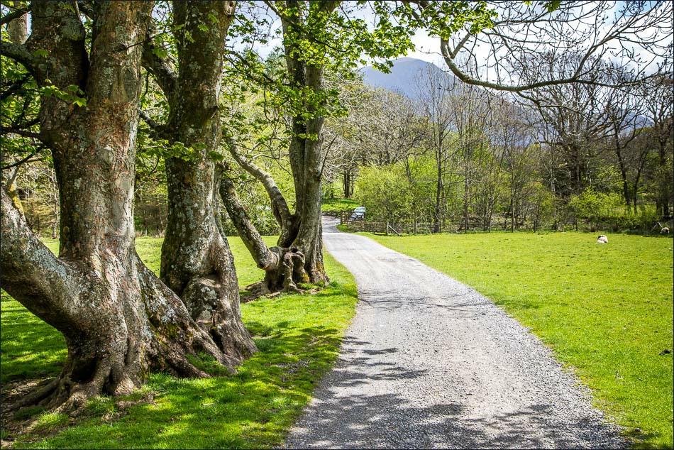
I follow the sign to High Nook Farm and will return via Water Gate Farm

Crossing Dub Beck

Carling Knott and Holme Wood from the track to High Nook Farm

Looking across to Mellbreak

New dry stone wall


Highnook Beck, just before the farm

Beyond the farm now, and looking back to Darling Fell and Low Fell

The path heads up the valley, before turning back along the fellside to the right

Footbridge over Highnook Beck, at the start of the terraced walk along the flank of Carling Knott

The path climbs up above Holme Wood

Looking across to the track from High Nook Farm

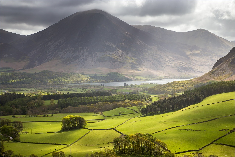
Grasmoor and Mellbreak

Looking back along the path, High Nook Tarn can be seen - it’s out of sight lower down

Crummock Water

Sweet Lorton Vale

Mellbreak

Crummock Water

Hen Comb

The light was changing by the second, and progress was slow along this section as I kept stopping to admire the views


The path follows the contours of Carling Knott and then Burnbank Fell ahead, but I turn off to head down into Holme Wood

Entering Holme Wood


Unfurling fern

Primrose


Holme Force


Wild bluebells


I join the path along the shore of Loweswater


Bonnie

I wonder who lives here?

The bothy by the lakeshore, available to rent from the National Trust

Low Fell

Mellbreak

Whin Ben leading up to Whiteside

Darling Fell


The lovely track from Water Gate Farm which leads back to the start, looking towards Whiteside and Grasmoor


Rannerdale Knotts and Fleetwith Pike can just be seen above the trees
Back to the start - what a wonderful walk
