Route: High Rigg
Area: Central Lake District
Date of walk: 2nd August 2016
Walkers: Andrew
Distance: 5.6 miles
Ascent: 1,100 feet
Weather: Cloudy with one or two bright patches
The weather forecast predicted a 90% chance of cloud free summits in the morning and based on those decent odds I’d planned to climb Blencathra. I made a very early start but sadly the top of the mountain was covered by thick clouds and there would have been no views. Gone are the days when I’d climb a fell in any weather in order to bag it, so I quickly came up with a plan B and parked at the foot of nearby High Rigg, one of my favourite lower level fells
I made my way up the southern end of the fell and then across the long knobbly summit ridge. There were good views of Blencathra ahead but it still had its head in the clouds – I’d made the right decision
As the end of the ridge I descended to the little church. Just beyond it there are two possible return routes, an elevated one along the eastern flanks of High Rigg and another along the valley floor. I took the latter, having taken the former last time here
It was a pleasant stroll back through St John’s in the Vale and thanks to the early start I finished the walk by 10.30am
For other walks here, visit my Find Walks page and enter the name in the ‘Search site’ box
Click on the icon below for the route map (subscribers to OS Maps can view detailed maps of the route, visualise it in aerial 3D, and download the GPX file. Non-subscribers will see a base map)

Scroll down – or click on any photo to enlarge it and you can then view as a slideshow

Sunset the day before the walk - Criffel in Scotland from the North West Lake District

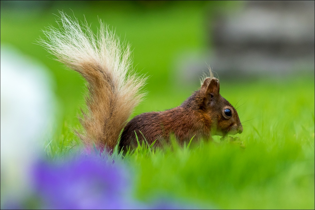
Just after dawn next morning a red squirrel in the garden

The start of today’s walk - the ladder stile at the foot of High Rigg with the A591 behind me

The climb starts immediately, initially through woodland

The way ahead

Looking back to Great How

…and again, with the A591 running beside it - the key to getting from the north to the south Lake District

The long spine of the eastern fells

Pine trees on Wren Crag

Looking back to Castle Rock


Thirlmere

Looking back past Great How

A down and up to the highest part of the ridge

Blencathra in the clouds

Thirlmere and Raven Crag

Great How again

Looking back to the A591…

…and to Great How and Thirlmere

My return leg along St John’s in the Vale below

Further along the summit ridge

Clough Head on my right

Looking back along the ridge

I pass by a small tarn

Another down and up as I make my way along the ridge to the summit cairn

Good light on the crags of Clough Head


Bassenthwaite Lake comes into view

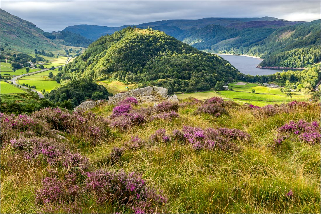
Lots of lumps and bumps looking across to Bleaberry Fell

Summit cairn on High Rigg, looking towards Blencathra - click here for another view from here last March

The lower crags of Clough Head again

Blencathra, still in the clouds

Looking down to Bridge House, the half way point of today’s walk

After an easy descent from the ridge, I pass by St John’s Church

I leave the quiet lane from the church and follow the sign for Bridge House

I cross a small footbridge near Bridge House

In common with other properties in the valley, Bridge House was badly affected by Storm Desmond and the awful floods last December

Just beyond the house, St John’s Beck

St John’s in the Vale - the haunt of buzzards and heron which we often see when we walk along this valley, and today was no exception

St John’s Beck

Further along the valley floor…


I walk past Sosgill Bridge

Sign near Low Bridge End Farm - teas and cakes are usually available here, but the farm has been another victim of the flooding and the cafe is closed at the moment

The valley path has merged with the higher level one by now, and carries on towards the end of St John’s in the Vale

The path climbs above the beck, with steepish drops further up, and rounds the toe of High Rigg


Back to the ladder stile and the discordant sound and sight of cars whizzing along the A591. Thankfully it only takes me a minute or so from here before I’m whizzing off home in my car

Later that day, another red squirrel