
Route: Goulceby and Red Hill
Area: Lincolnshire Wolds
Date of walk: 6th September 2024
Walkers: Andrew and Gilly
Distance: 3.9 miles
Ascent: 300 feet
Weather: Sunny but hazy
The Lincolnshire Wolds is designated as an Area of Outstanding Natural Beauty on account of its rolling hills, hidden valleys, gentle streams and unspoilt villages. It’s a wonderful location for a quiet country walk and it felt good to be back here after an absence of two years. We started today’s walk from the quiet village of Goulceby, which derives its name from the first major settler in the area, Kolkr the Dane. As the settlement expanded, his ‘Eystri’ or eastern lands became known as Asterby
We parked in the car park opposite the Three Horseshoes pub – the landlord kindly permits walkers to park here (we’d repay the kindness later by buying a drink). We joined the long distance Viking Way which runs through the village and across fields to Asterby. We turned left along the road here and followed it for about half a mile before turning right at a junction with Top Lane. A narrow and at times rather overgrown path took us uphill to the Red Hill Nature Reserve, named after its outcrop of rare red chalk. We followed a path around the reserve, home to a wildflower meadow known as ‘Coronation Meadow’. We were too late in the season to see the meadow at its best but there was plenty of field scabious, wild thyme and knapweed still in flower
There’s a good view over a large swathe of Lincolnshire countryside from the top of the hill, but it was very hazy today. We followed the road downhill in the direction of Goulceby and when we met the road we crossed it, passing through a gate in a wall which leads into the farmyard of Manor Farm. After following the path through the farm we continued across the fields until we reached an old graveyard, the site of the first Goulceby church. From here we strolled back into Goulceby to end a very pleasant amble during the course of which we hadn’t seen another walker
Click on the icon below for the route map (subscribers to OS Maps can view detailed maps of the route, visualise it in aerial 3D, and download the GPX file. Non-subscribers will see a base map)

Scroll down – or click on any photo to enlarge it and you can then view as a slideshow

The start of the walk from the car park opposite the Three Horseshoes, Goulceby

We follow the road beside a stream leading out of the village

We turn left here and follow the sign indicating the Viking Way

We follow the Viking Way towards Asterby...


A short road section through Asterby

We pass by St Peters Church Asterby, which is now redundant and is privately owned


We continue along the road beyond Asterby for a short distance...


Looking across to Red Hill, the far point of the walk

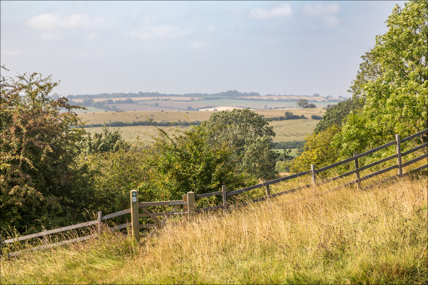
At a junction with Top Lane, we leave the road and head uphill along a narrow and sometimes overgrown path

Red Hill ahead, only 400 feet above sea level, but a mountain in these parts


A view back along our path

Coronation Meadow, Red Hill Nature Reserve - one of the 60 Coronation Meadows across the UK to mark the 60th anniversary of the Coronation of Queen Elizabeth

The area comprises 4 acres of chalk grassland with some scrub, a further 4 acres of old plateau grassland, and a disused quarry with a famous exposure of red chalk which is rich in fossils

There are extensive views across the surrounding countryside, not seen at their best in the hazy atmosphere today

We follow a path around the reserve...


We leave Red Hill Nature Reserve here and descend along a quiet lane in the direction of Goulceby...


The road ends at Manor Farm

The next part of the walk is easily missed. Our path lies through a gate in the wall

A public footpath runs through the yard of Manor Farm

The landowners have provided an alternative path to the public one, and we followed this (on the right of the hedge) so as to respect their privacy

Beyond the farm we follow a path through the fields

Looking back to Manor Farm and to Red Hill beyond

We follow this path across a recently harvested field

We pass through the site of the first Goulceby church, All Saints. Nothing remains of the church. The oldest readable tombstone in the graveyard is dated 1738

Beyond All Saints we follow a path through the fields back into Goulceby

A well earned pint at the Three Horseshoes pub in Goulceby, reminding us of more familiar walking areas
