
Route: Chalets du Mouet
Area: Chablais Alps, France
Date of walk: 20th August 2018
Walkers: Andrew and Gilly
Distance: 6.9 miles
Ascent: 800 feet
Weather: Mostly sunny, very hot
Today was the last day of a wonderful walking holiday in the Chablais Alps. We decided on a high level route which would take us up to 2,000 metres, over 6,500 feet, but thanks to the skiing infrastructure which exists in these parts we’d only have to climb 800 feet
We left our base at the excellent Hotel Macchi in Châtel and made our way up to the Super Châtel gondola, which whisked us up the mountainside in no time at all and with zero effort on our part. We then walked over to the nearby Morclan chairlift, which gave us another effortless leg up to 6,500 feet. The views from the top of the lift were spectacular, albeit rather hazy, and included the 3 Swiss Alpine giants – Eiger, Mönch, and Jungfrau
We set off along the ridge, which initially involved a steep and rocky ascent and descent. At the end of the descent we walked across the meadows to join a grassy path with steep drops to our right – this section was easy going, and although the mountain scenery was spectacular there were no vertigo issues. The undulating path followed the border between France and Switzerland and at times we found ourselves walking from one country into the next
Eventually we reached a col where a decision had to be made. We could have continued along the ridge, but this involved an additional ascent and descent, the use of chains and some real exposure, so we opted for a less challenging route which would bypass these obstacles and take us to the far point of the walk, Chalets du Mouet. A cooling beer went down well here and suitably refreshed we continued our journey, which was a long and easy descent via paths and tracks back down into Châtel – the end of a great walk and a great holiday
Some notes in conclusion: for anyone interested in the practicalities, we booked our holiday through Inntravel, who arranged the 3 hotels at which we stayed, and also the onward transfer of our baggage from one place to the next, plus a taxi back to the start in order to collect our hired car. We were provided with a local map, the French equivalent of the Ordnance Survey 1:25,000 maps, along with detailed notes of the walking routes on offer. In over 50 miles of walking we didn’t go astray once. Thank you Inntravel for organising everything so efficiently
Click on the icon below for the route map
![]()
Scroll down – or click on any photo to enlarge it and you can then view as a slideshow

We walk through Châtel to the base of the Super Châtel gondola

The gondola will take us up to a height of 5,400 feet

We alight at the upper station and make our way over to the Morclan chairlift

The chairlift will give us another effortless leg up to 6,500 feet

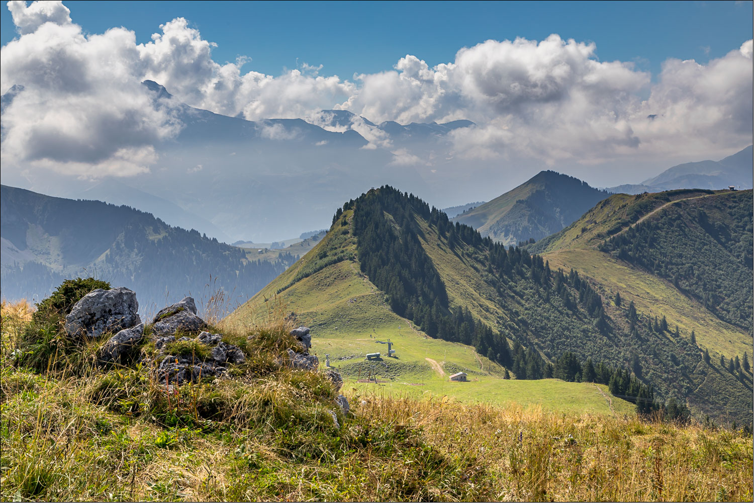
We disembark from the chairlift, and the route immediately becomes apparent - we will follow the ridge ahead

Le Morclan, looking back down into the Abondance Valley

Sadly the long distance views are hazy but on a clear day we'd be able to make out some of the Alpine giants, including the Eiger, Mönch and Jungfrau

The French/Swiss border lies partially along the ridge and we'll be walking in both countries at different times


We reach Col de Folieres and start the climb to Pointe des Ombrieux, which is quite steep near the top

Just below the top

Pointe des Ombrieux, with Switzerland on the right, and the border just a couple of feet away

We descend towards Porte d'Onne, with a hazy view of Lake Geneva/Lac Leman to the right

Our path will take us along the edge of the ridge

Looking down into Switzerland

A view back to Pointe des Ombrieux

The Swiss Alps

We continue along the ridge line

Looking back - the photos along this section of the walk were taken on the Swiss side of the border

Lake Geneva again

A patch of poisonous monkshood as we continue along the ridge

Looking back to Pointe des Ombrieux, with the Dents du Midi in the distance at over 10,000 feet

Jagged rocks on the Swiss side of the border

We continue along the undulating ridge

A precipitous drop into Switzerland below

Looking back

A granite border marker and we are back in France - just

Cornettes de Bise in the distance

Butterflies in abundance in these high meadows, including a mating pair bottom left

This butterfly landed on my walking boot and lingered there for two or three minutes, attracted by the fragrant smell no doubt

From Tête de Tronchey, at 6,240 feet, a view of various peaks, including Le Mouet on the left and Cornette de Bise left of centre

We arrive at a small chalet and start the long descent back to valley level

We're heading for Chalets de Mouet on the right of the photo

We carry straight on at the signpost

Looking across to our destination, Châtel

Approaching Chalets de Mouet

View from Chalets de Mouet, with Châtel below

A refreshing ice cold beer, resting on our trusty map of the Morzine area

We continue our descent

Looking across to Mont de Grange

A short woodland section...


Above Châtel

We pass below the gondola which we'd taken at the start

Looking along the Abondance Valley. We'd started our holiday in Abondance which is out of sight around the corner, and weaved our way along the valley at high level

Back to Châtel - the end of a walk, and a journey. Many thanks to all at Inntravel for organising such an unforgettable walking holiday
