
Route: Castle Crag
Area: North Western Lake District
Date of walk: 8th October 2022
Walkers: Andrew and Gilly
Distance: 4.5 miles
Ascent: 1,000 feet
Weather: Cloudy with sunny spells, several showers
Castle Crag and its neighbouring fell King’s How are known as the ‘Jaws of Borrowdale’, and anyone who has driven into the valley will know why this is – these two sharp peaks form the gateway to Borrowdale, one of the loveliest square miles in the Lake District
We often start this walk from Rosthwaite, which saves a mile or so, but today parked in the National Trust car park at Seatoller. The approach to Castle Crag from the path below High Scawdel is the finest approach to the fell and one of the best paths in the Lake District. We climbed up the fellside heading west out of Seatoller, and then joined the elevated path which runs along Borrowdale
Castle Crag soon came into view and before long we arrived at the foot of the fell. Standing at 985 feet, it’s the lowest of the lakeland fells as classified by Wainwright, and the only one under 1,000 feet to make an appearance in his guides. Its rugged appearance and wonderful position caused Wainwright to break his own rule and to award the fell the ‘full treatment…a distinction well deserved’.
It’s a steep but short climb to the summit and near the top the path consists of loose slate, the remnants of quarrying which once took place here. After admiring the wonderful views we retraced our steps down the loose slate path to seek out the descent path down into Borrowdale, which enjoys more glorious views. We arrived back at valley level and here we joined the path by the bank of the River Derwent, which would be our companion for much of the return leg. It’s an easy walk back apart from a slightly awkward rocky section just beyond the Youth Hostel at Longthwaite, where chains assist a traverse above the river. All too soon we arrived back in Seatoller to end a superb short fell walk
For other walks here, visit my Find Walks page and enter the name in the ‘Search site’ box
Click on the icon below for the route map (subscribers to OS Maps can view detailed maps of the route, visualise it in aerial 3D, and download the GPX file. Non-subscribers will see a base map)

Scroll down – or click on any photo to view as a slideshow, with options to comment and share on social media

The day before the walk, a red squirrel in the rain...

...and the wonderful view over Crummock Water from Crummock Water Cottages

Next day, the start of the walk, looking back to Seatoller and its fell as we climb out of the village

Views of Borrowdale...


Looking back along our path

The Honister pass below on our left as we continue to climb uphill

Looking across to Seatoller Fell

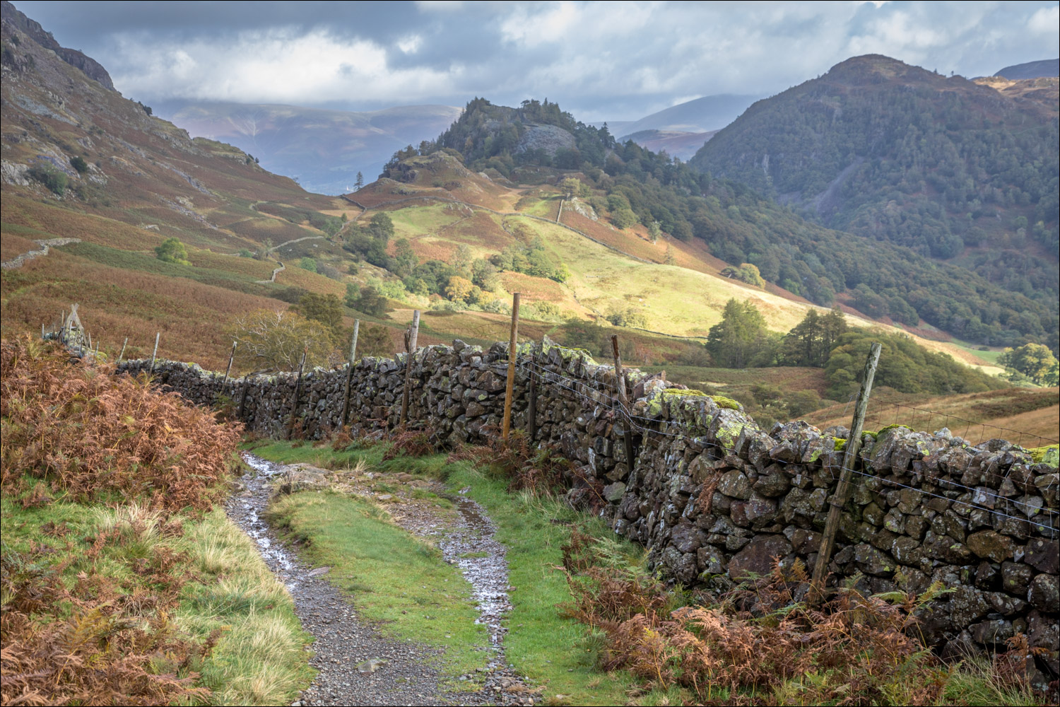
After turning right at the higher path, the first view of Castle Crag

Castle Crag and King's How, collectively known as the Jaws of Borrowdale

Rapidly changing light between sunshine and showers as we follow the heavenly path towards Castle Crag...


Borrowdale and the River Derwent on our right

We cross a footbridge over Tongue Gill

Waterfall in Tongue Gill

Stonethwaite at the head of Borrowdale

Derwent Water comes into view as we arrive at a hause below Castle Crag. We turn right here to start the ascent of the fell

It's a fairly steep but short climb

Another incoming shower

We arrive at a flat grassy area

The last part of the climb is up a loose scree path made out of a spoil pile of slate - a reminder of the quarrying which took place here

Looking back along our direction of travel

Slate cairn below the summit of Castle Crag

More evidence of the old slate quarry

We arrive at the summit area, here looking across to King's How, the other Jaw of Borrowdale

The Castle Crag memorial - the fell was gifted to the National Trust in 1920 by Dr W H Hamer as a memorial to 2nd Lieutenant John Hamer and the men of Borrowdale who died in the First World War

Views from the summit - Borrowdale....

...Derwent Water and Skiddaw, and a faint partial rainbow....

...and the path we followed to get here, right of picture

We descend by retracing our steps to the grassy area below the summit, and will turn left after crossing a stile

Wonderful views of Borrowdale as we descend...


We arrive at the valley floor and follow the path to the River Derwent

The River Derwent, looking towards High Doat and Johnny Wood

We pass by Grade II listed New Bridge near Rosthwaite

We continue beside the river. Just beyond the YHA hostel at Longthwaite there's a rocky section where chains assist

Looking along the River Derwent

Approaching Seatoller

Seatoller, and the end of a wonderful walk
