
Route: Black Hambleton
Area: North Yorkshire
Date of walk: 21st August 2019
Walkers: Andrew
Distance: 8.4 miles
Ascent: 1,100 feet
Weather: Mixed cloud and sunshine, a couple of showers
Black Hambleton is a plateau on the western edge of the North York Moors, and defines the northern extremity of the Hambleton Hills. It is also the highest of the Hambleton Hills at a height of 1,308 feet
I parked at Square Corner on Thimbleby Moor, which is a couple of miles beyond the village of Osmotherley. The way ahead was obvious from the start of the walk, and I set off south along a wide track, heading in the direction of Black Hambleton, the prominent hill rising directly ahead. After a short distance I branched off to the right to join the track leading into Silton Forest. The track took me gently downhill through the forest, eventually emerging onto farmland below the western edge of the Hambleton Hills
After following a succession of lanes, tracks and paths through the fields I arrived at Nab Farm, roughly the half way point of the walk, and this signalled a change in the nature of the terrain as I gradually climbed up to Kepwick Moor. This was the scenic highlight of the walk, and it was fortunate that good weather coincided with this section, showing the views at their best. The huge panorama included the Vales of York and Mowbray, and rivalled those I’d enjoyed on a recent visit to nearby Sutton Bank
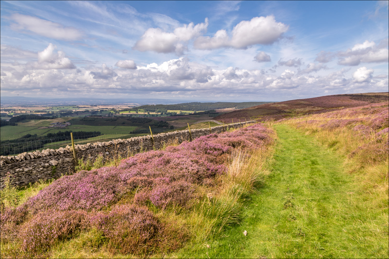
At the top of Kepwick Moor I joined the Cleveland Way and followed this over the shoulder of Black Hambleton, enjoying more good views which were enhanced by the flowering heather. Navigation here was a simple affair and I continued along the waymarked Cleveland Way, descending gently down the Hambleton Drove Road back to the start. It had been a superb walk
Click on the icon below for the route map (subscribers to OS Maps can view detailed maps of the route, visualise it in aerial 3D, and download the GPX file. Non-subscribers will see a base map)

Scroll down – or click on any photo to enlarge it and you can then view as a slideshow

Earlier this week, five hedgehogs paid us a visit - we've been seeing one or two most nights, but it was a thrill to see an 'array' or 'prickle' as they are described collectively

The start of today's walk from Square Corner, where there is free parking for several cars

Black Hambleton ahead - I follow the Hambleton Drove Road towards it

I branch off to the right at the sign ahead, and will rejoin the drove road at the end of the walk

The outskirts of Silton Forest

Further into the forest

One of the 1,000 mileposts funded by the Royal Bank of Scotland which mark the creation of the National Cycle Network

Silver birch in Silton Forest

Further along the forest track, which gradually descends to valley level

The track, known as Moor Lane, continues to Nether Silton but I leave it here and turn left into the fields

The start of a section through farmland which twists and turns but the direction of travel is south...


At Honeykiln Farm, there were cows with calves in the fields, causing momentary uncertainty, but the farmer happened to be there and assured me of safe passage...


I continue through a succession of fields...


A short walk along Bridge Beck Lane brings me to a cottage below Nab Farm, marking the approximate half way point of the walk

The start of the climb up to Kepwick Moor as I look across the fields to Silton Forest, where I'd been earlier

Nab Hill

A view back over the Vale of Mowbray to the distant Pennines

Nab Farm ahead, and I follow a path through the farmyard, which is to the right

Beyond the farm now, and climbing up to Kepwick Moor

I cross Old Gill

Onto open moorland now - I searched for the perfect photo to follow this one, but in vain

I'm aiming for the line of the ridge ahead...


As I gain height, the retrospective views over the Vale of Mowbray towards the Pennines get better and better...


I arrive at the top of the moor and join the Cleveland Way, which I'll follow back to the start

Curlew and lapwing may be seen here, though I was out of luck today

Further along the waymarked track

More big views across the Vale of Mowbray as I continue along Black Hambleton...


The start of the descent in the direction of Osmotherley

The parking space ahead, mid left of picture

Back to Square Corner, and a final glance up to Black Hambledon at the end of a superb walk
