
Route: Aira Force and Ullswater
Area: Eastern Lake District
Date of walk: 31st October 2019
Walkers: Andrew
Distance: 4.5 miles
Ascent: 1,000 feet
Weather: Sunshine and blue skies
After yesterday’s strenuous walk up remote and mountainous Glaramara, I planned a gentler low level route today. As it turned out I found myself tackling a much harder obstacle than anything encountered yesterday, about which more later
It’s been some time since I last visited the Ullswater area, and I wanted to visit the woodland around Aira Force for some more autumn colour. My usual walk here is the classic Gowbarrow Fell circuit, but I’ve done that often and was looking for a new route. After joining up some dots on the OS map I came up with a circuit which would combine a walk in the woods, a visit to Aira Force, and views of Ullswater
As it was still half term, and Aira Force is a popular tourist attraction, I arrived early and was the first to park in the National Trust car park at High Cascades. After crossing the road and passing through a field I arrived at Aira Beck. I turned right here and followed the path through the woods, passing by several waterfalls, both large and small. I made a short detour to see the main fall – spectacular Aira Force, which falls 70 feet from below a stone footbridge. I then left the woodland to join a path above Lyulph’s Tower. The path is clearly not used very often, but it’s easy enough to follow. The junction to the higher path is easily missed, and when I arrived at a deer gate I realised I’d gone too far and retraced my steps. Some rock steps, which were partially hidden by bracken, took me uphill towards the rockface of Yew Crag. It was here that I made a mistake and started up a steep gully, which appeared to be a continuation of the route. Once committed it was easier to continue than backtrack, but it was a very difficult ascent, and I had no idea what lay ahead. Hands were needed, and I’d describe it as a scramble, though more agile walkers may call it an enjoyable clamber. The OS map on the Maps Page shows where I went wrong. Eventually I emerged onto easier ground and made my way across to a stile just below the higher level return path
Just beyond the stile I joined the Ullswater Way near the location of the Memorial Seat. The views across Ullswater from here are wonderful, and can be enjoyed as the path, one of the finest in lakeland, is followed back into the Aira Force woodland. After retracing my steps for a short distance I followed a path on the other side of Aira Beck, crossing a wooden footbridge higher up. From here it was a short walk back to the car park
For other walks here, visit my Find Walks page and enter the name in the ‘Search site’ box
Click on the icon below for the route map (subscribers to OS Maps can view detailed maps of the route, visualise it in aerial 3D, and download the GPX file. Non-subscribers will see a base map)

Scroll down – or click on any photo to enlarge it and you can then view as a slideshow

The start of the walk from High Cascades car park as I head for the woods below Gowbarrow Fell

I follow an easy path down through the field

Aira Beck below

I follow the National Trust sign for Aira Force, and will return via a path on the other side of the footbridge

Cascades in Aira Beck as I follow a path downhill....


I cross this bridge, with a plaque bearing the words 'This bridge was built by friends in memory of Stephen Edward Spring Rice C.B, 1856-1902'

I make a short detour to Aira Force. Blinding sunlight to the left and above made it impossible to take a decent photo

I follow this path out of Aira Force woods

The start of the lower path above Ullswater...


Views of Ullswater open up...

This is looking towards the head of the lake

Lyulph's Tower below, built in the 1780s by Charles Howard, the 11th Duke of Norfolk, as a hunting lodge

The path continues through Dobbin Wood...


I pass by this old stone bench

It was around here, below Yew Crag, where I turned uphill and somewhere along the way left the path shown on the OS map

After an awkward scramble up a gully, it was a relief to reach easier ground, where wonderful views of Ullswater began to appear...


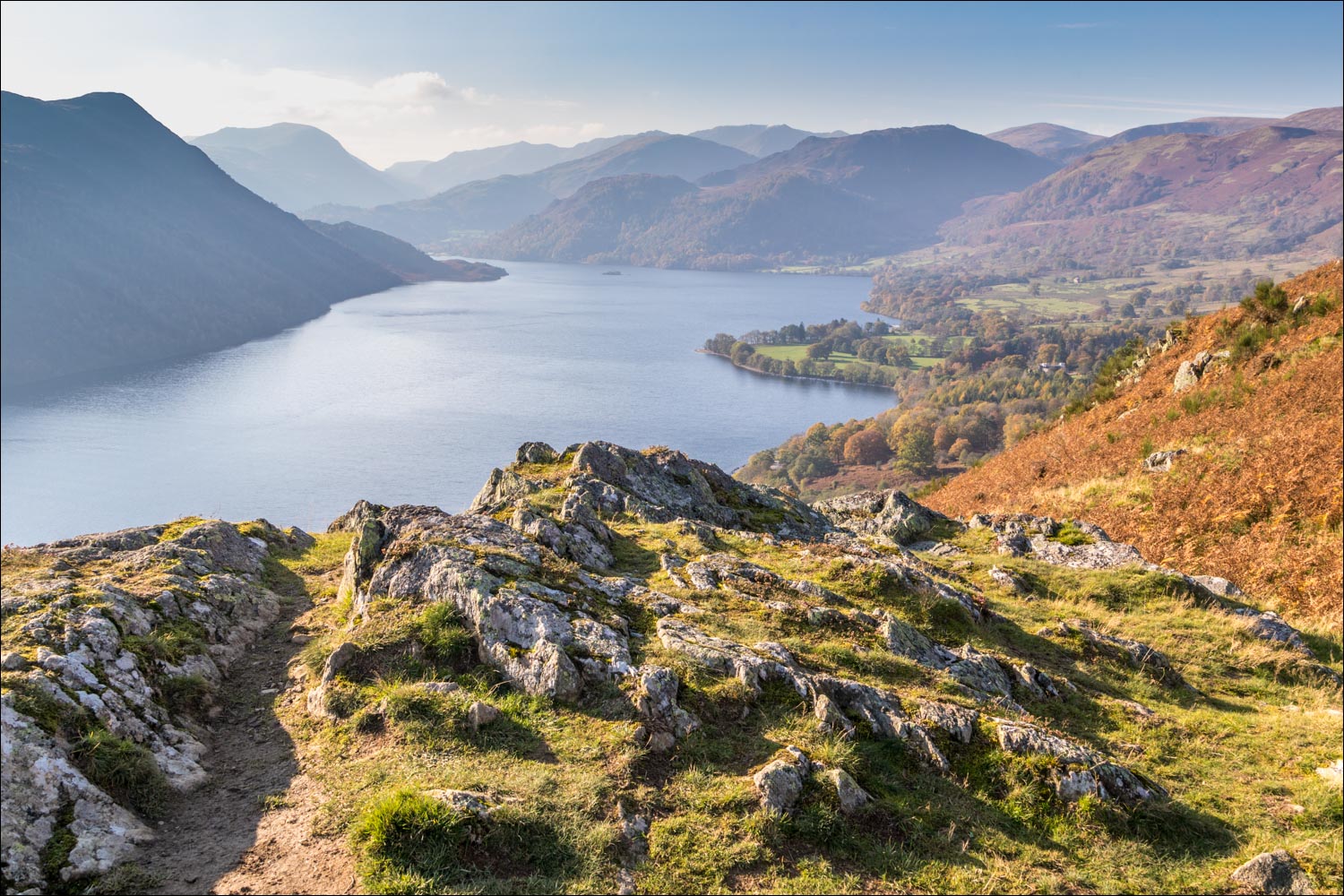
Looking towards the foot of the lake from a rocky plateau

One of the Ullswater Steamers passes by below

I cross the stile and after a few yards join the wonderful higher level path heading back to Aira Force

Beyond this gate lies a small rock promontory with a cairn and a big view...

...Ullswater in all its glory


The Memorial Seat, shown on the OS map, and inscribed ‘A thank-offering - 1905’

I continue along the path, part of the Ullswater Way, with views of the lake on my left...


I pass above Lyulph's Tower again

I re-enter Aira Force Woods and follow a path with Aira Beck on my left - the falls weren't visible from here, but their roar was audible


The end of the walk as I cross Aira Beck via this footbridge and retrace my steps to the start
