
Route: High Stile Range
Area: Western Lake District
Date of walk: 25th March 2016
Walkers: Andrew James and Tom
Distance: 9.4 miles
Ascent: 3,100 feet
Weather: sunny in the valley but very cold, windy and misty on the tops
Our son James and nephew Tom both have fond memories of the classic High Stile Range walk, so it didn’t take long to decide on today’s route. We parked in the National Trust car park on the edge of Buttermere and walked across the foot of the lake. The climbing starts as soon as Burtness Wood is reached and once we were above the tree line we were enjoying wonderful views back over the lake
It was a warm sunny day, T-shirt weather, but it was as well that we packed full winter gear since it very quickly became colder as we ascended and by the time we’d scrambled up the steep final section of Red Pike it was absolutely freezing. Gloves and hats were a necessity
We started out on the wonderful ridge walk leading firstly to High Stile and then High Crag. At times there was very limited visibility in the mist but there were frequent gaps in the cloud offering thrilling glimpses of the spectacular rock scenery all around
As we started the steep descent down Gamlin End, James identified the place where I’d taken his photo at age 6, and from the same spot I took another one – 20 years on. After the knee jarring climb down Gamlin End we picked up a path (easily missed) which took us to Scarth Gap Pass. On reaching Buttermere we decided to take the path back along the far shore which would give us views across the lake to the fells we’d just climbed
We arrived back at the start tired but happy after a fantastic day in the fells
For other walks here, visit my Find Walks page and enter the name in the ‘Search site’ box
Click on the icon below for the route map (subscribers to OS Maps can view detailed maps of the route, visualise it in aerial 3D, and download the GPX file. Non-subscribers will see a base map)

Scroll down – or click on any photo to enlarge it and you can then view as a slideshow

Red squirrel in the garden brightening up a rainy day yesterday

Next day on the way to Buttermere - the High Stile Range has its head in the clouds

Start of the walk as we pass by Crag Houses and look up to our intended destination

The Fish Inn Buttermere

We follow the track to the foot of Buttermere

Bonnie dived straight in to the lake as usual

The Shake - guaranteed to drench anyone standing within a 10 foot radius

We cross the footbridge over Buttermere Dubs

James climbing the rocky staircase through Burtness Wood

Above the wood now and looking to Fleetwith Pike at the head of Buttermere

Robinson

Looking back to Buttermere

Sourmilk Gill

Chapel Crags towering over James and Tom near Bleaberry Tarn

We walk past the tarn to follow the path up to our first summit - Red Pike

Looking back to Bleaberry Tarn

The outlying fell of Dodd, with Crummock Water to its left

A lingering patch of snow on the last steep section - syenite in the rocks causes the red colouration which gives the fell its name

The head of Crummock Water through the mist from the summit of Red Pike

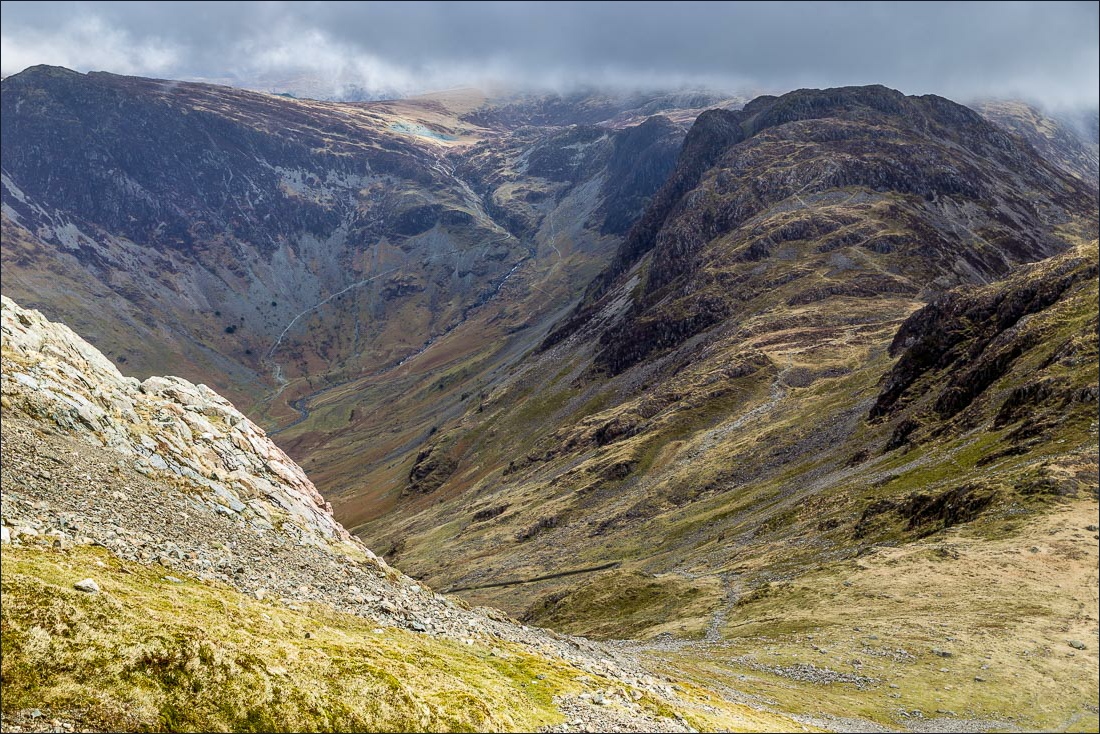
Wonderful mountain scenery on the way to the next fell High Stile, which will be the highest point of the walk at 2,644 feet

As we walk above Chapel Crags, with Bleaberry Tarn below, we can see Keswick and Blencathra in the distance

Thick mist followed for a while, but lifted as we left the summit of High Stile to walk towards High Crag

The thrilling path hugs the edge of Comb Crags

The way to High Crag

Head of Buttermere


High Snockrigg and Robinson

Bonnie again

Approaching the summit of High Crag

There follows the steep descent down Gamlin End

James aged 6 - 20 years ago

From exactly the same spot - 20 years later

Looking down to Gatesgarth and the start of the Honister Pass

Warnscale Beck

Wainwright’s favourite fell - Haystacks…

…and in black and white, looking like a sketch by the great man himself

Warnscale Bottom

Descending to Buttermere…


We’ll be following the track to Gatesgarth shortly

The bothy at the head of Buttermere

Peggy’s Bridge

Buttermere pines


Looking across the lake from the shoreline path


Into the tunnel…

…and out again

Looking back to Haystacks

Buttermere village ahead, and the end of an unforgettable walk

A golden end to a golden day at the nearby Kirkstile Inn
