
Route: Great Crag
Area: Central Lake District
Date of walk: 16th August 2024
Walkers: Andrew and Gilly
Distance: 5.6 miles
Ascent: 1,400 feet
Weather: Mostly cloudy with a few sunny spells
Great Crag is a mid-level lakeland fell which is covered with a coat of purple heather at this time of the year. Hoping for more of the same, we decided to revisit the fell
We parked just outside the small hamlet of Stonethwaite, where there are several roadside parking spaces. About halfway through the village we turned left and crossed nearby Stonethwaite Beck via Stonethwaite Bridge, turning right immediately to join the Cumbria Way for a short distance. We then left the Cumbria Way to join a path heading uphill. This is easily missed – look out for an old sheepfold at the junction. It was a steep climb, but the addition of rock steps made the ascent a straightforward affair and before long we arrived at Dock Tarn. The tarn is surrounded by numerous mounds and tors, all covered with heather, and it’s a lovely sight. In the words of Alfred Wainwright, ‘Dock Tarn is a place to lie adreaming, and life seems a sweet sweet thing’
In common with its neighbour Grange Fell, Great Crag is a complicated place, full of ups and downs, and determining the summit and the path to it is not a simple affair. There are numerous small paths, some of which peter out. There are two tops on the fell, both marked by cairns. Both are wonderful spots and there’s little to choose between them. After admiring the views we descended to rejoin the main path below and headed in the direction of Watendlath and its tarn. The path took us across some wild and very juicy terrain leading to Puddingstone Bank. It’s possible to extend the walk by continuing down to the idyllic hamlet of Watendlath but we didn’t have time for that today, so descended alongside Bowdergate Gill. The path offers wonderful views into Borrowdale. Eventually it merges with the Cumbria Way and the path continues beside Stonethwaite Beck back into Stonethwaite to end a superb walk
For other walks here, visit my Find Walks page and enter the name in the ‘Search site’ box
Click on the icon below for the route map (subscribers to OS Maps can view detailed maps of the route, visualise it in aerial 3D, and download the GPX file. Non-subscribers will see a base map)

Scroll down – or click on any photo to enlarge it and you can then view as a slideshow

We walk into Stonethwaite


We turn left at this cottage and head to Stonethwaite Bridge

Stonethwaite Beck from Stonethwaite Bridge

Having turned right beyond the bridge we follow the Cumbria Way for a short distance

We leave the Cumbria Way and turn left at this marker post, which is easily missed

We pass by an old sheepfold, with Eagle Crag in the distance

Looking back to Stonethwaite

We cross a stile to start a steep climb up through the woods

Looking back down the rocky path

We emerge from the woods onto open fellside which is covered in heather at this time of year

Eagle Crag, and Stonethwaite Beck below

Seatoller and the Honister Pass, with Fleetwith Pike beyond

Langstrath and Rosthwaite Fell

Willygrass Gill, which is never far from the path

Langstrath and Langstrath Beck

Looking back over a stile to Eagle Crag and Langstrath

Looking back to Rosthwaite Fell...

Willygrass Gill again

We pass by Dock Tarn...


The summit of Great Crag is just beyond the tarn and is reached after a short and simple climb. Watendlath and its tarn are below, and Skiddaw is in the background

Looking the other way, to Rosthwaite in Borrowdale

We descend towards Watendlath

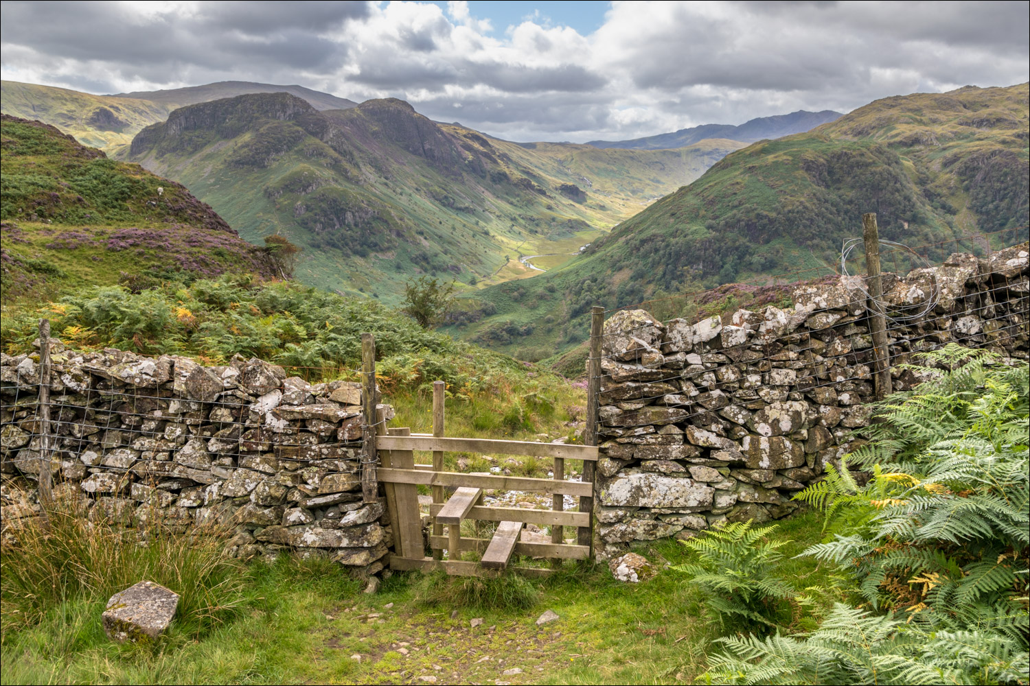
We pass through the gate below and follow a path across juicy terrain

Watendlath again - we hadn't enough time to visit the village so took a short cut across to Puddingstone Bank

Views back to Great Crag...


The start of a wonderful descent back into Borrowdale...


Rosthwaite below

We follow the path above Rosthwaite as it curves around the lower slopes of Great Crag...


Rosthwaite Fell

The path merges with the Cumbria Way...


Eagle Crag comes into view again as we head towards Stonethwaite Bridge

We cross Stonethwaite Bridge and walk though the village to end a wonderful walk
