
Route: Aird a’Mhorain
Area: Outer Hebrides, North Uist
Date of walk: 5th March 2024
Walkers: Andrew and Gilly
Distance: 6.6 miles
Ascent: 200 feet
Weather: Sunny at first, soon clouding over, very windy
On the first day of a short stay on North Uist we decided to visit a headland on the north of the island known as Aird a’Mhorain. There are three beaches on both sides of the narrow neck of land – Tràigh Iar, Tràigh Ear and Tràigh Udal. This walk would visit all of them
We parked at the road end beyond Grenitote where there is a small parking area (an honesty box suggests a donation of £2). We set off along a sandy track at the edge of Tràigh Ear, crossing a small burn via some slippery stepping stones. The burn can be avoided by a detour inland if the water is high. We soon arrived on the golden sands of Tràigh Ear and walked along the beach, accompanied by numerous oystercatchers along the way. We reached a spit of land known as Corran Aird a Mhorain which we crossed to reach the outer beach. We’d heard that this is a good place to spot otters but were out of luck today
Eventually the sands petered out to be replaced by pebbles and at this point we headed up onto grassy terrain to reach the cemetery of the Macleans of Boreray. The small island of Boreray can be seen beyond the cemetery. We continued towards the highest point of the headland, the OS trig point at the summit of Aird a’Mhorain, a good viewpoint – which we had to cling onto to avoid being blown off our feet! From here we descended to Tràigh Udal on the west side of the headland. At the end of the beach we crossed over a small hillock, at which point we were beset by ferocious winds which were sandblasting our faces. Progress from here on became arduous. The return via Tràigh Iar and its dunes wasn’t the pleasant experience it should have been, and it was a relief to arrive back at the start of an otherwise wonderful walk
Click on the icon below for the route map (subscribers to OS Maps can view detailed maps of the route, visualise it in aerial 3D, and download the GPX file. Non-subscribers will see a base map)

Scroll down – or click on any photo to enlarge it and you can then view as a slideshow

The first day of our stay in the Outer Hebrides, and the start of the walk from the small car park and picnic area beyond Grenitote

We cross a small burn by Tràigh Ear - there are some loose stepping stones to the right of the picture

Looking across Tràigh Ear towards Harris

We walk along Tràigh Ear, with oystercatchers feeding on the wet sands nearby....


Looking back along the sand dunes, with a gale force wind driving in from the sea

At the end of the dunes we cross a narrow spit of land at Corran Aird a'Mhorain, to the right of the picture

We arrive at the outer beach of Tràigh Ear and will walk over the headland in the distance, Aird a'Mhorain

Looking back along the beach

We reach a pebbly section near the end of Tràigh Ear, and leave the beach here to follow a parallel path above it

We follow a track across the dunes of Aird a'Mhorain


Via a circuitous route, as we'd been on the wrong side of a barbed wire fence, we arrive at the cemetery of the Macleans of Boreray

This is the last resting place for the chieftains and families of the Macleans, who on death were rowed here by 10-oar galley from Boreray for service at the chapel here and for burial

Looking out to Boreray, with the hills of Harris in the distance

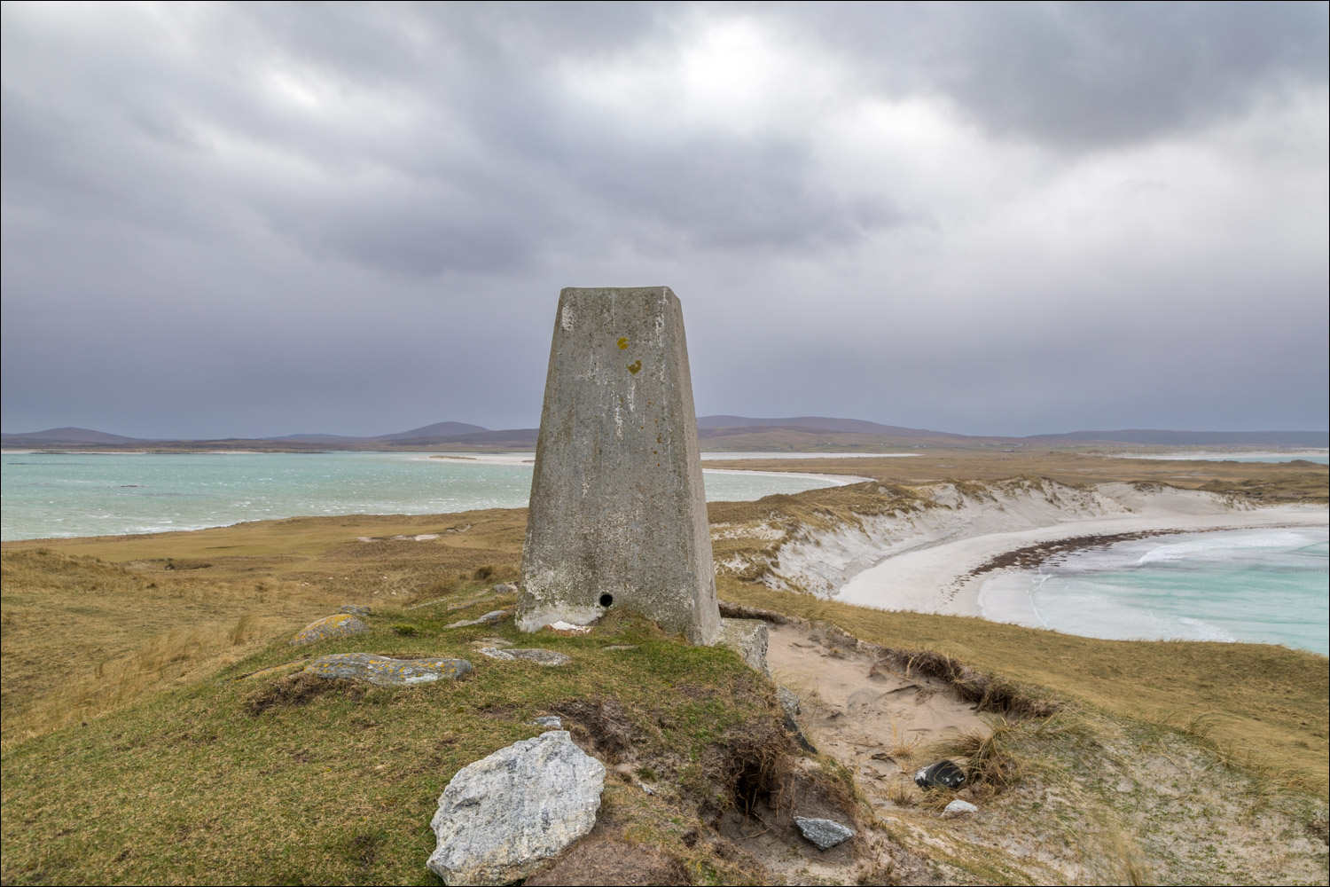
After leaving the cemetery, we climb up to the nearby trig point on Aird a'Mhorain, the highest point in the area. I was nearly blown over by the ferocious wind here. We make our way to the beach on the right of the picture

We descend towards Tràigh Udal

We pass through the gate below and turn right

We follow a path over the dunes

We scramble down the dunes onto Tràigh Udal


We walk along deserted Tràigh Udal


Looking back towards the trig point on Aird a'Mhorain

We leave Tràigh Udal at this point to climb back up to the dunes

A bench near Udal - we would have lingered here but for the howling wind

We walk back over the dunes

We made a short detour to view a third beach, Tràigh Iar. It might have been possible to follow the beach, but we weren't sure if we'd be able to get back up the 20 foot high dunes

The last section of the walk was a struggle as a gale force wind blowing towards us was sandblasting our faces, but it had been a great walk nevertheless

On the way back we stopped the car to admire this traditional crofter's cottage
