
Route: Wansfell Pike
Area: Far Eastern Lake District
Date of walk: 26th November 2013
Walkers: Andrew
Distance: 8.5 miles
Ascent: 1,700 feet
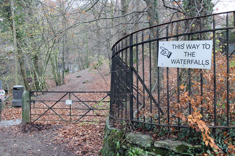
I parked in the main car park near the centre of Ambleside and followed the sign ‘To the Waterfalls’. I soon arrived at Stock Ghyll Force, a local beauty spot
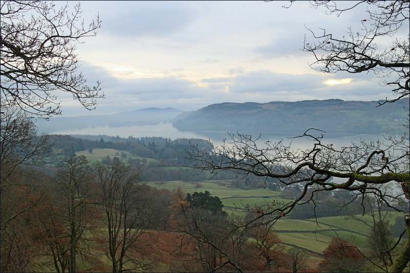
After taking a few snaps, I continued uphill onto open fellside and joined a well made path up to the top of Wansfell Pike. Along the way I kept stopping to look back at the lovely views over Ambleside and towards the Southern Fells
Having reached the top, I descended to the pretty village of Troutbeck, then joined Robin Lane, a delightful track from which there are views of Windermere
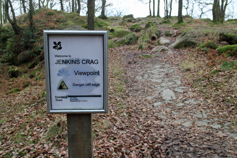
On the way back I made a couple of minor diversions, the first to Jenkins Crag for a high level view of Windermere and the second to Waterhead for a view from the lake shore
The weather was cloudy but this didn’t spoil the walk, which I enjoyed every step of the way
For other walks here, visit my Find Walks page and enter the name in the ‘Search site’ box
Click on the icon below for the route map (subscribers to OS Maps can view detailed maps of the route, visualise it in aerial 3D, and download the GPX file. Non-subscribers will see a base map)

Scroll down – or click on any photo to enlarge it and you can then view as a slideshow

Bridge House Ambleside
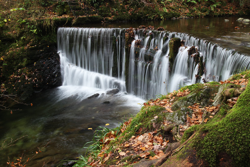

Stockghyll Force

Leaving the woods and entering onto Wansfell

Wansfell Pike ahead

Looking back down to Ambleside

Wansfell Pike

Windermere

Ambleside

Heading down towards Troutbeck

Nanny Lane, just before Troutsbeck

One of the many attractive cottages in the village

From Robin Lane, a glimpse of Windermere

Further along Robin Lane

Looking towards Bowfell and the Langdale Pikes
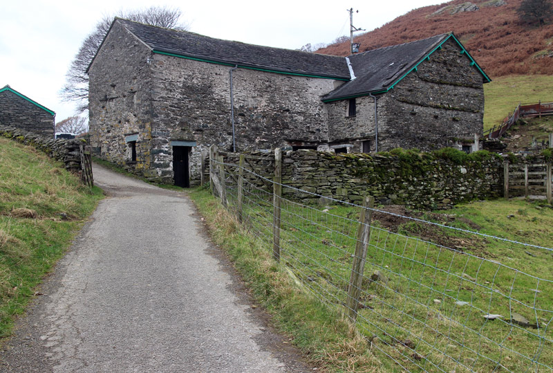
The track passes through a farmyard

There were some lovely views of Windermere from this track
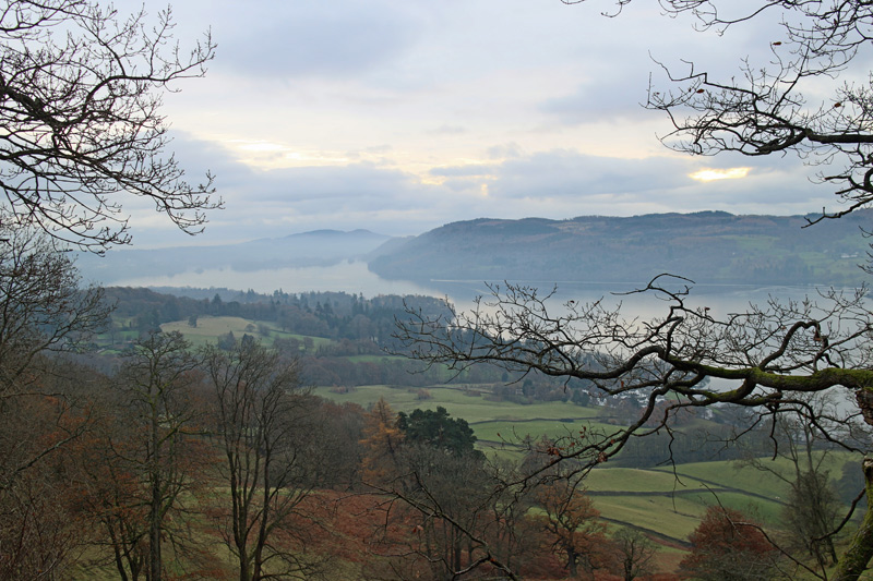

Windermere from Jenkins Crag……

……and from Waterhead, back at Ambleside
