
Route: Circuit of Buttermere
Area: Western Lake District
Date of walk: 24th January 2020
Walkers: Andrew and Gilly
Distance: 5.1 miles
Ascent: 400 feet
Weather: Low cloud with some breaks
The weather forecast was very negative today – low cloud and drizzle, and based on this we didn’t plan an ‘Andrew’s walk’, but decided to take our retriever Bonnie on a dog walk round Buttermere instead. At the last minute I took the camera with me, just in case conditions improved, which seemed unlikely judging by the conditions on the way to Buttermere. Thick clag was enveloping the surrounding fells, and all was gloom
When we parked in our usual spot, the National Trust car park at Long How, there were signs of improvement and as it turned out we enjoyed the walk in good light at times
The circuit of Buttermere appears over 20 times on this site and is one of the classic low level walks in the Lake District. The beauty and accessibility of the walk is both a virtue and a problem, in that the path can be too busy at peak times and if you prefer to walk in relative solitude, then it’s best to choose a quiet day and time. Such was the case today, and we only passed by a small handful of people during the course of two hours
We walked through Buttermere village, passed by the Fish Inn, and followed the path to the foot of the lake. After crossing the new footbridge over Buttermere Dubs we set off along the lakeshore path which leads to the head of Buttermere. We were fortunate today, since our arrival at the head of the lake (possibly the most beautiful section of the walk) coincided with some good light as patches of sun broke through the clouds
After crossing Peggy’s Bridge and passing by Gatesgarth Farm we started the return leg along the other shore, following a recently improved path. We passed through the short tunnel in the rocks near Hassness and continued beside the lakeshore along a path which is quite rocky at times. This brought us back into Buttermere village to end a walk which we could never tire of
For other walks here, visit my Find Walks page and enter the name in the ‘Search site’ box
Click on the icon below for the route map (subscribers to OS Maps can view detailed maps of the route, visualise it in aerial 3D, and download the GPX file. Non-subscribers will see a base map)

Scroll down – or click on any photo to enlarge it and you can then view as a slideshow

We walk past Cragg House Farm at the start of the walk, with High Stile in the background

Looking towards Crummock Water, a fogbow


We follow the path to the foot of Buttermere

The new footbridge over Buttermere Dubs

Burtness Wood

The path takes us around a small promontory

Fleetwith Pike at the head of Buttermere

Horse Close ahead

Muddock Crags from Horse Close

Haystacks is up on the right, but we carry on towards the head of the lake

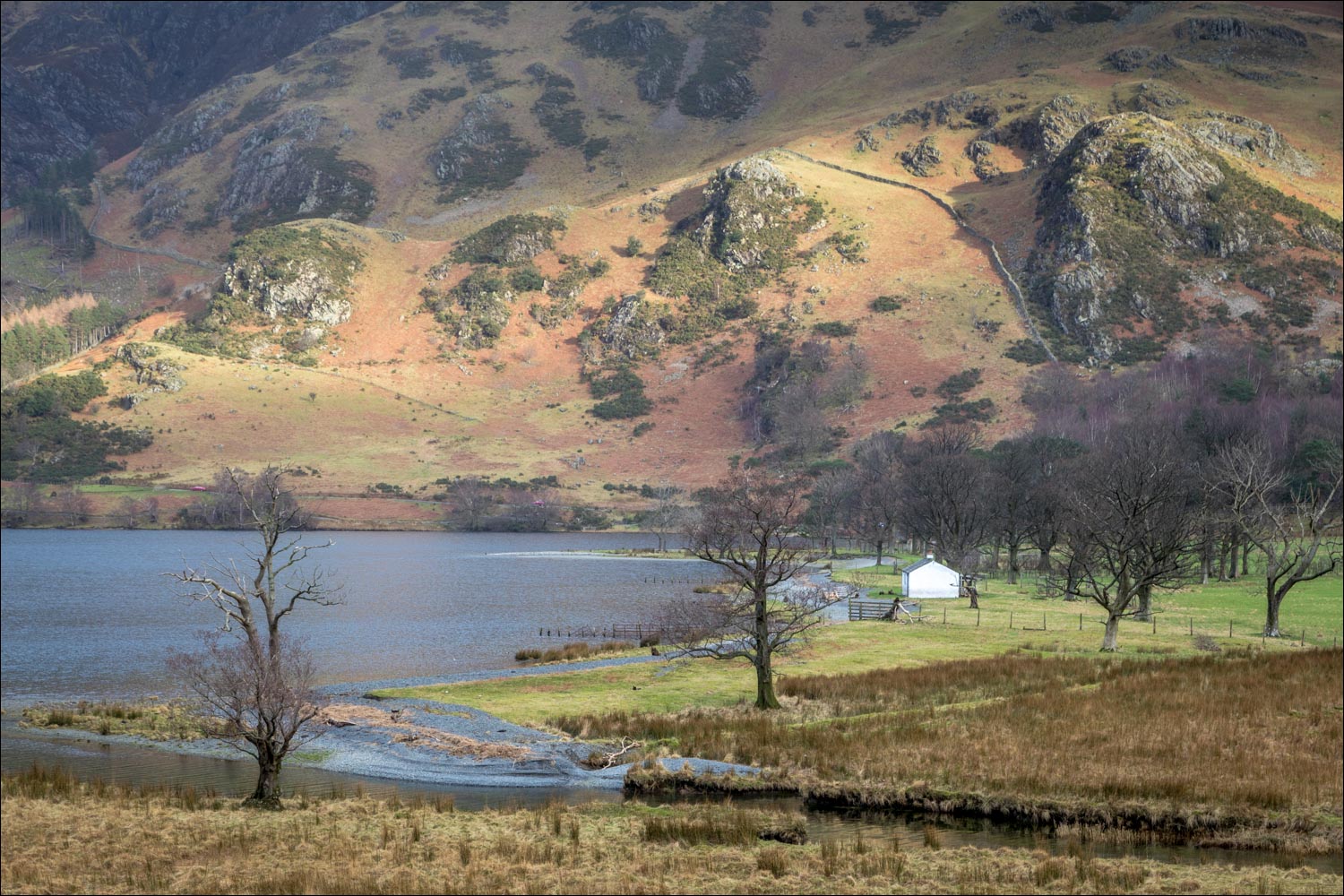
The white bothy at the head of Buttermere

Warnscale Bottom ahead - we'll turn left at the dry stone wall

The 'white hut' again

Looking back along our path

Warnscale Bottom again

Another view back - the High Stile Range is up on the left, most of it in the cloud

The path across the head of Buttermere, leading to Gatesgarth

From Peggy's Bridge, Buttermere pines and Warnscale Beck

Looking the other way - Rannerdale Knotts is in the background

How now brown cow - one of the docile highland cattle which graze around here

Warnscale Bottom on our right at we head towards Gatesgarth

Looking back to High Crag

We pass through Gatesgarth Farm at the foot of the Honister Pass

Start of the return leg as we pass by Low Crag near the head of Buttermere

The improved path leading to Hassness

We walk round the lovely promontory at Hassness...


The fogbow, or possibly a rainbow, is still there

This pine tree always catches my eye when I walk past it...


Beyond Hassness the path becomes a little rougher, though there are no difficulties

Into the tunnel, carved out in the 19th century by a Manchester Mill owner. If you're over 6'6'' you will need to duck to avoid a sore head

Light at the end of the tunnel

Looking back to Haystacks on the right

High Stile in the clouds

We pass by the foot of the lake

Buttermere village and Rannerdale Knotts

Looking across to Old Burtness and the waterfall in Sourmilk Gill

A final look back towards the head of Buttermere

A vintage car as we pass through Syke Farm in Buttermere village

St James' Church, and from here it's a short stroll back to the car park and the end of the walk
